
Renfrewshire Council will review flood prevention arrangements as a report to councillors has confirmed that forecasts before Storm Boelo in late October significantly underestimated tidal levels on the river Clyde and no local flood warning was issued.
The report focuses on the impact suffered in Renfrew where the River Clyde reached its highest recorded level since digital records began in 1998, with resultant flooding in the area, including to 13 businesses.
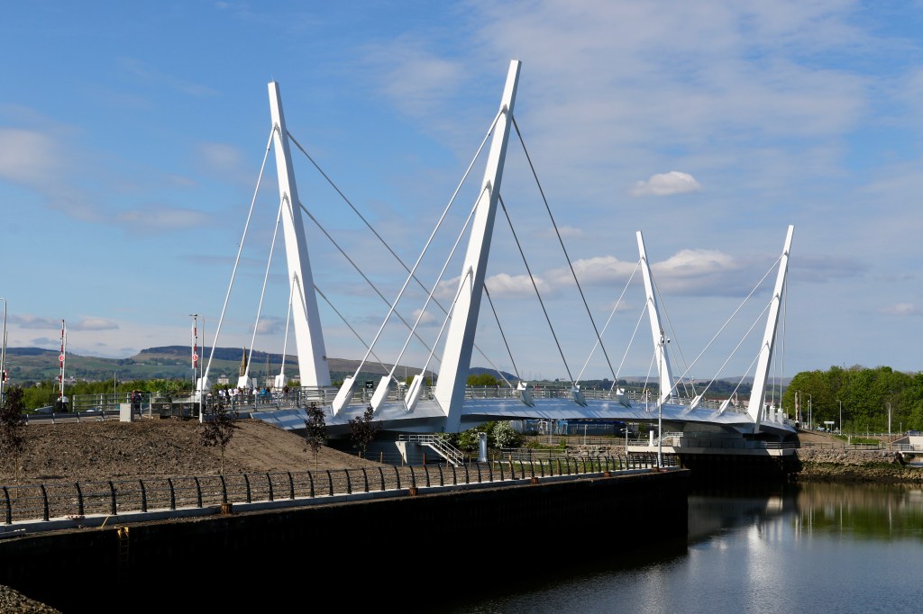
The southern plant room which controls the Renfrew Bridge also suffered extensive damage rendering the swing bridge inoperable, leaving it closed to road users for a number of months while investigations and repairs are carried out.
The Council will now undertake a comprehensive review in partnership with the Scottish Environment Protection Agency (SEPA) and other stakeholders to understand why the actual level of the River Clyde differed so significantly from forecast levels and to identify any improvements required to forecasting arrangements, warning systems, operational protocols and wider flood resilience measures.
Key points in the paper, which will be considered at the Council’s Infrastructure Land and Environment Policy Board tomorrow (Wednesday 4 November 2026), include:
- No Flood Warning was issued by SEPA for Renfrew ahead of Storm Boelo (24-25 October 2026) and no concerns regarding exceptional tidal levels were raised through Local Resilience Partnership arrangements involving multiple agencies.
- Highest-available tidal forecasts (adjusted for land levels) for Renfrew of 2.2m to 2.42m were below the Council’s established protocol for (i) deploying staff to the flood barrier to observe and respond to any risk of water overtopping from the river (forecast tidal levels of 3.6m) and then (ii) raising the barriers (forecast tidal levels of 3.9m). In the end the evening tide was recorded at 4.49m, the highest since digital records began in that location in 1998.
- The Renfrew flood barriers were not activated following an established process which has been developed through operational experience, historic events and flood risk assessments. There have been 45 amber and red alert weather warnings for the Strathclyde area since 2016 with no flood alerts which met the threshold for activating the barriers.
- The Council is currently aware of 13 businesses who had water ingress impact. Eight of these businesses are on the river side of the barriers at Ferry Road and would have been impacted regardless of barrier deployment.
- All businesses the Council has been able to contact have been offered support, with staff also attending to remove waste material earlier this week. Of the 13 businesses impacted, ten are understood to now be back open and operating.
- The issues experienced at Renfrew Bridge were entirely unrelated to the deployment of the flood barrier. Current assessments indicate that disruption may continue for a number of months while investigations, repairs and future resilience measures are completed.
- The bridge, which opened in May 2025, is within its two-year defects period and the contractor and the council’s insurers are now investigating whether a defect was responsible for the significant water ingress.
The review will also assess the implications of disruption to local communities if a lower threshold for activation of the barriers was considered given this would result in the barriers being raised more often as a precaution when conditions may ultimately prove such action was unnecessary.
While this review is progressed, the Council has introduced temporary measures around the North Renfrew Flood Scheme to reduce the threshold for deploying operational teams to visually assess actual conditions and raise the barriers if required.
Gordon McNeil, Renfrewshire Council’s Director of Environment, Housing and Infrastructure, said:
“This report is an important step in setting out the facts surrounding the response to Storm Boelo, the information available and the decisions taken as a result. A number of Renfrew businesses and individuals experienced flooding that weekend and we of course acknowledge the difficult time they faced.
“While the report shows in some detail that officers followed the established procedures correctly, based on the information they were provided with by partners as part of established planning arrangements, it is important we work with our partners to understand why the forecasting was significantly different from what we subsequently experienced.
“The Council, like all local and national governments, must also consider whether, in the event climate impacts are increasing in severity, we should introduce a more prudent approach to our operational procedures to protect residents and businesses from this uncertainty as best we can. The review will also consider what the trade-offs and costs of such an approach might be.”
The £10m North Renfrew Flood Prevention Scheme was introduced in 2016 to reduce flood risk to homes, businesses and infrastructure. The scheme comprises the pumping station at Mill Burn on Fingal Road, a 1km-long, 2.3m-high embankment and two barriers built into Ferry Road and Fishers Road.




Leave a Reply